Track Progress. Reduce Risk. Build Smarter.

Construction Monitoring

Track progress, verify work, and detect issues before they escalate. Our aerial insights keep your projects moving—on time and on budget. Smarter oversight from above, with zero disruption on-site.

Smarter Site Management from Above

Site Survey

Capture high-resolution orthomosaics and generate 2D/3D maps with ±2 cm accuracy.

Progress Monitoring

Track construction stages over time with repeatable drone flights.

As-Built Documentation

Create precise visual records of structures and surfaces for verification, handover, or dispute resolution.

Safety & Compliance Checks

Use AI to detect missing PPE, perimeter breaches, or equipment zones.

Explore our services

Features

BIM (Building Information Modeling)

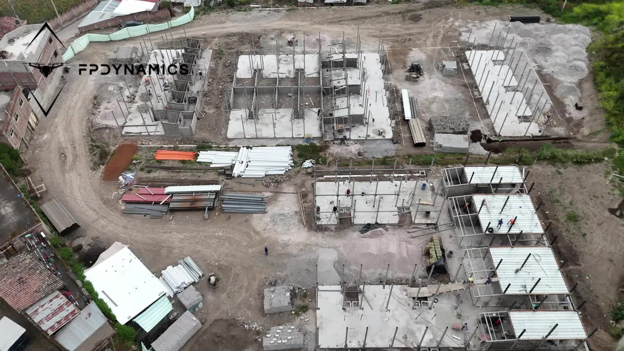
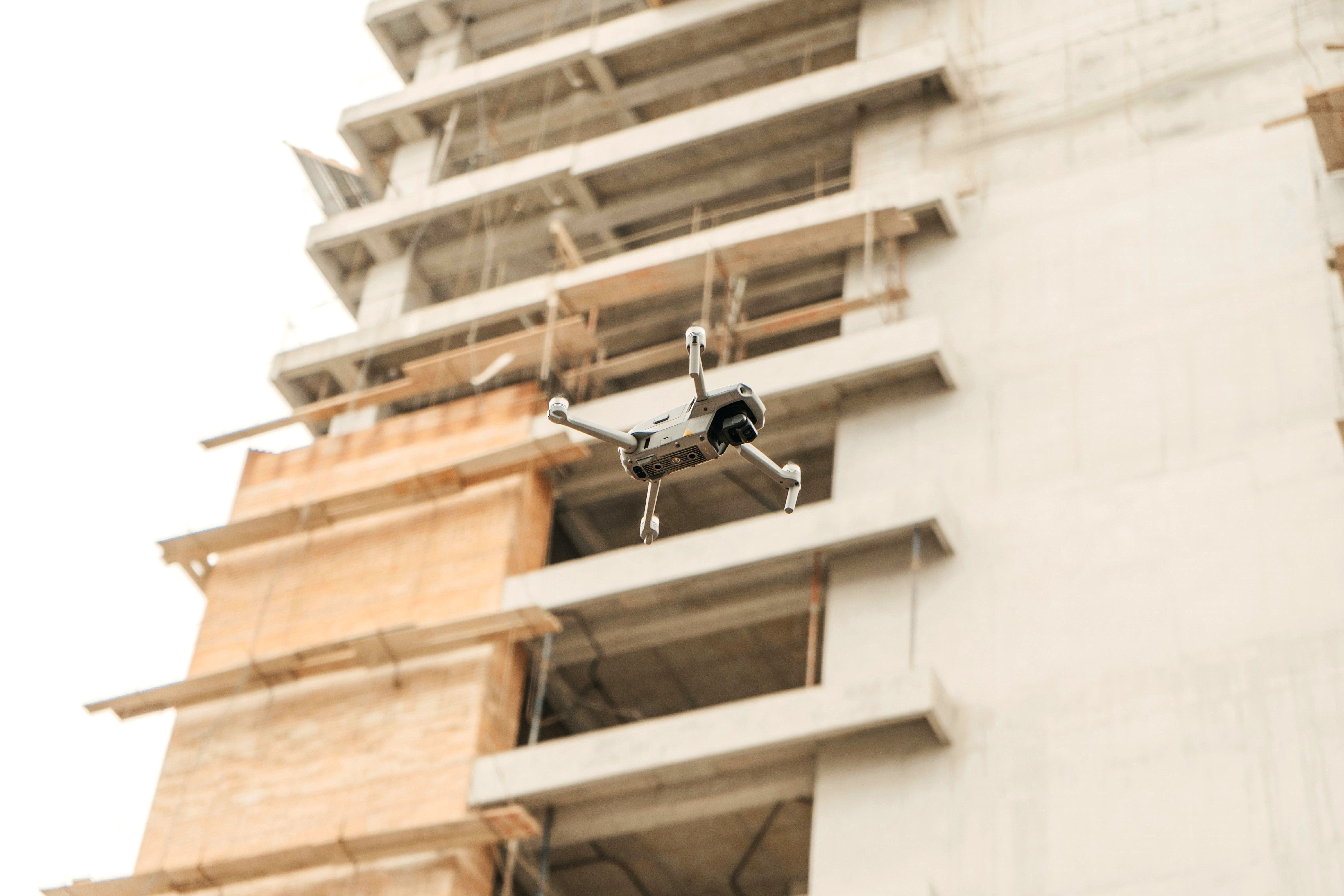
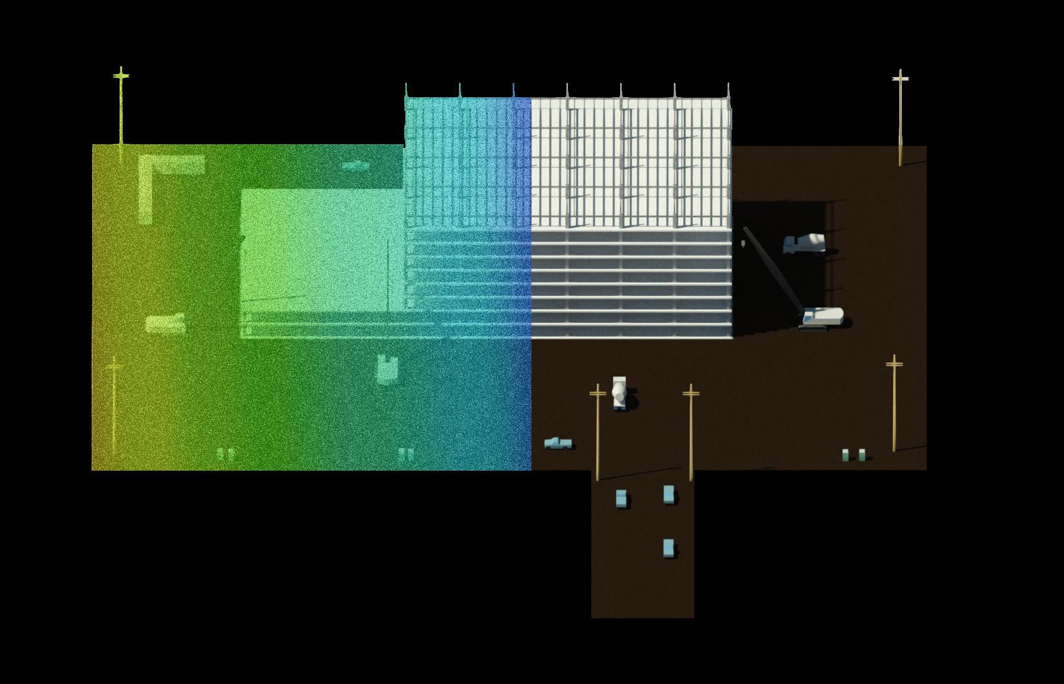
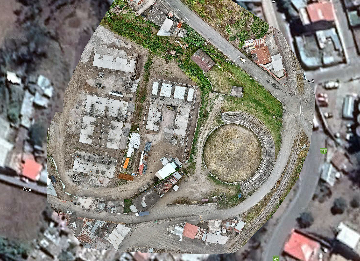
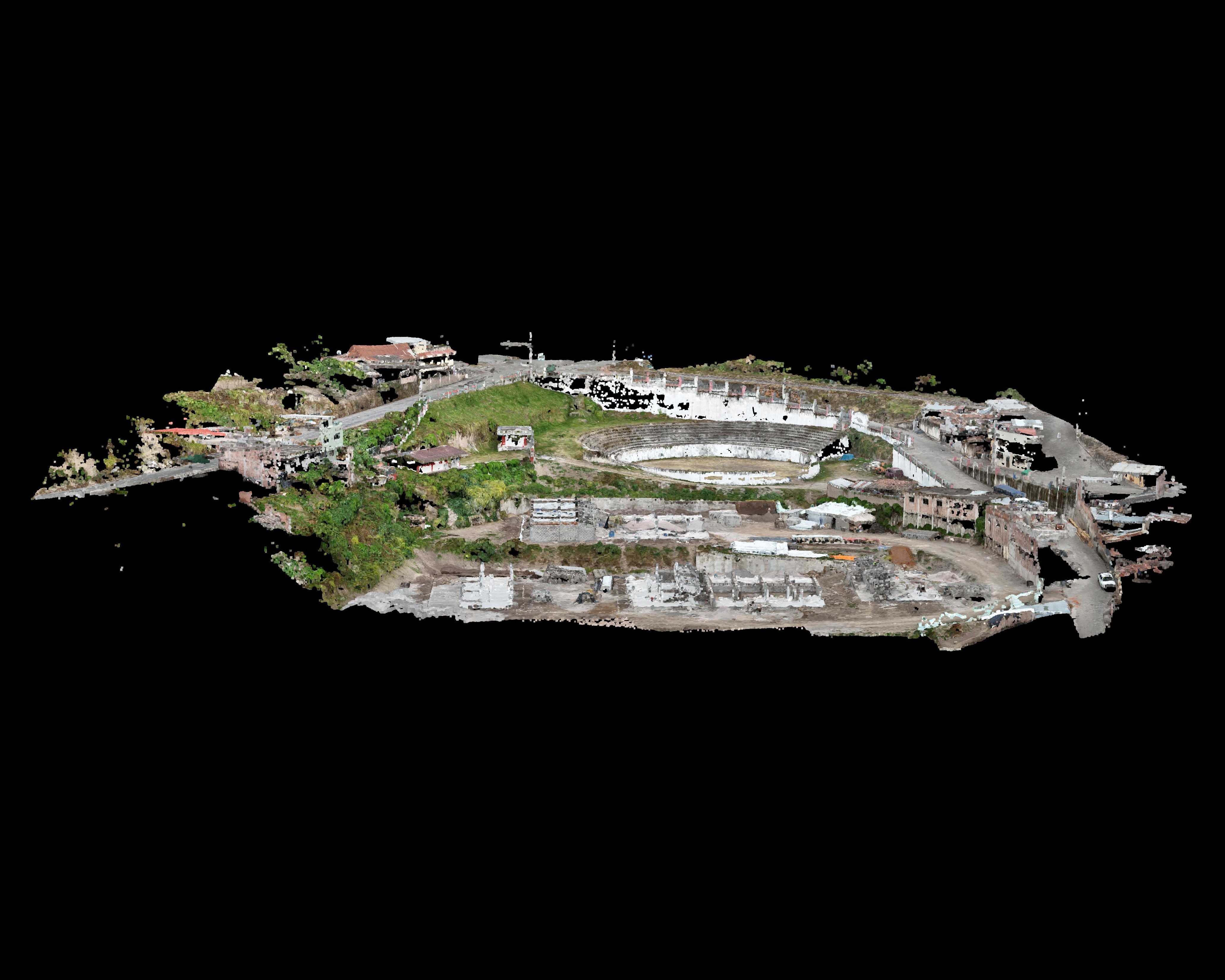
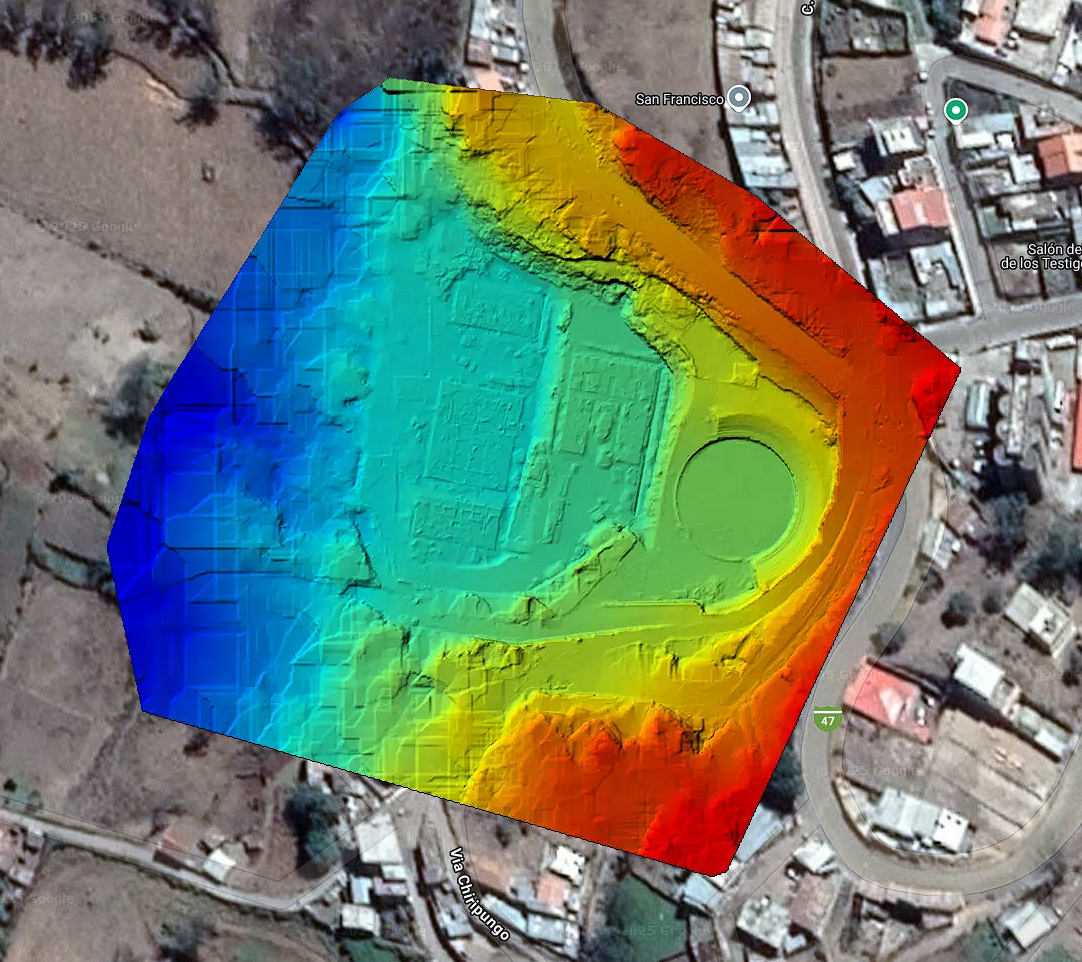
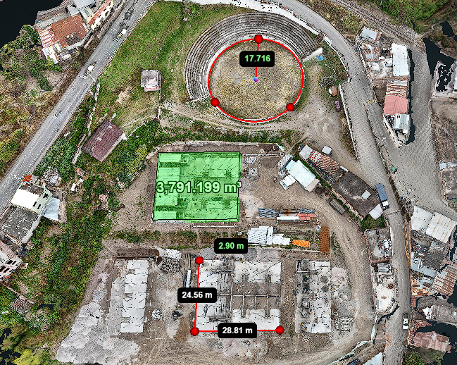
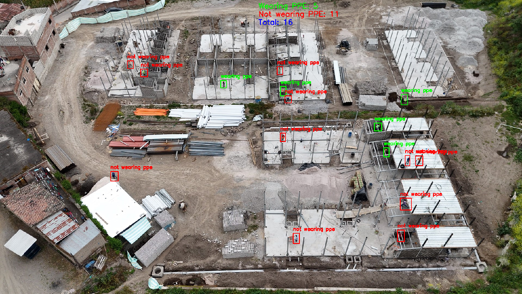
Turn the built environment into intelligent, data-rich building models. Our BIM services capture, model, and deliver highly accurate as-built information to support design, construction, and facility management.
  • Accurate As-Built Data: Transform drone scans into precise, detailed BIM models for reliable project planning and verification.
  • Streamlined Communication: Give all stakeholders access to a single, up-to-date model to reduce misunderstandings.
  • Lifecycle Asset Management: Embed material, equipment, and maintenance data for long-term building operation.
  • Improved Quality Control: Detect deviations between design and actual site conditions before they cause costly issues.
  • As-Built Documentation: Create models that reflect exact field conditions for record-keeping and compliance.
Features

🗺️ Orthomosaics

We produce high-resolution, geo-rectified maps with ±2 cm accuracy. A single 15-minute drone flight can replace hours of manual surveying, ideal for layout checks, measurements, and project coordination.
  • High-resolution, measurable site maps
  • Compare layout vs. plans
  • Prevent miscommunication with one visual source
Features

🧊 3D Modeling

Capture your entire site in 3D to detect elevation changes, grading issues, or missing elements. Cut/fill volumes and surface detail support better design validation and digital twin creation.
  • Cut/fill analysis for billing accuracy
  • Confirm slope, drainage, and surface quality
  • Archive 3D data for digital twin use
Features

🌄 Terrain/Surface Models (DTM/DSM)

Generate detailed elevation maps in hours — not days — with drone-based surveys. Perfect for planning earthworks, drainage, and verifying surface design before and after grading.
  • Generate baseline for cut/fill bids
  • Analyze water flow & drainage
  • Monitor grading over time
Features

📦 Volumetric Measurement

Quickly measure piles of material with centimeter-level precision. Get faster billing, inventory tracking, and machine calibration — without manual tools or risky on-foot checks.
  • Track stockpile inventory instantly
  • Validate machine calibration
  • Eliminate risky tape-based methods
Features

🦺 Safety & Environmental Compliance

We monitor PPE use, scaffolding, erosion control, and more without placing inspectors in harm’s way. All imagery is time-stamped and regulation-ready.
  • Document PPE, scaffolds, and erosion controls
  • Confirm fall protection remotely
  • Detect hazards without boots on the ground

Get a Custom Quote for Your Next Project

Aerial mapping, inspections, and AI insights
Precision drone data, AI-powered insights, and faster decision-making.
All in one streamlined solution.