Autonomous Aerial
Intelligence
Advanced autonomous drone systems and AI-driven analytics. Purpose-built for defence, engineered for precision across every sector.
Defence-Grade
Drone Systems
Purpose-engineered autonomous platforms with AI-driven threat detection, thermal imaging, and real-time situational awareness. Our systems minimize risk while delivering faster data collection and greater accuracy than traditional methods.
Autonomous ISR
AI-powered intelligence, surveillance, and reconnaissance with real-time target detection.
Thermal Detection
Onboard AI thermal imaging for personnel detection and perimeter security.
Counter-UAS
High-speed FPV platforms for rapid response in contested environments.
LiDAR Intelligence
3D terrain mapping and point cloud generation for mission planning.
Edge AI
Onboard deep-learning inference without reliance on external connectivity.
Custom Payloads
Modular hardware supporting EO/IR to SIGINT sensor configurations.
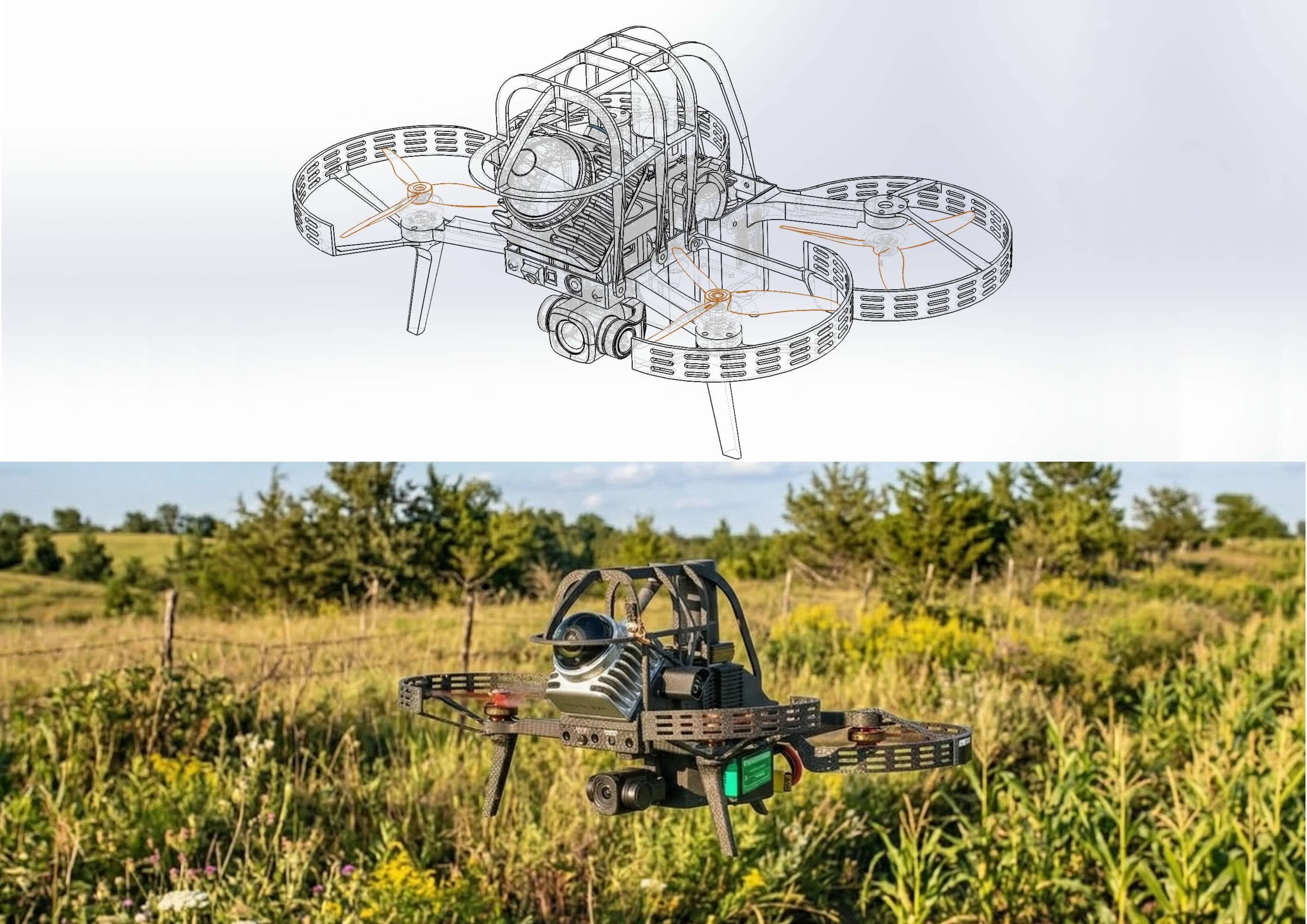
FP1 Autonomous
Drone System
Next-generation drone for high-precision autonomous flight and real-time data collection. Powered by Qualcomm processors, our deep-learning platform adapts to any mission. Built entirely in-house.
Industries We Serve
From defence operations to critical infrastructure, our platforms deliver actionable intelligence across every domain.
Defence & Security
Autonomous ISR, AI-driven threat detection, thermal imaging, and counter-UAS capabilities.
Capabilities
Our defence platforms combine autonomous navigation with AI-powered analytics for real-time intelligence in contested environments.
- Real-time AI-powered target detection and object classification
- Thermal camera systems with onboard person detection
- Autonomous indoor and outdoor navigation
- High-speed FPV-class platforms for counter-drone response
- LiDAR-based 3D point clouds for terrain intelligence
- Edge computing without external connectivity
Construction & Engineering
Progress monitoring, site mapping, volumetric analysis, and safety compliance with centimeter accuracy.
Aerial Mapping
RTK/PPK positioning and GCPs achieve ±2 cm accuracy. One drone surveys hundreds of acres in under an hour.
- Orthomosaics and 3D models for progress tracking
- DTM/DSM for grading verification and drainage
- Volumetric stockpile measurement
- BIM from drone scans for as-built verification
- AI-powered defect detection
- Automated change tracking across time-series scans
Precision Agriculture
Crop health analysis, yield optimization, and multispectral field intelligence.
Crop Intelligence
Multispectral and RGB imagery processed into NDVI maps for plant-level precision.
- Multispectral imaging for early disease detection
- NDVI mapping for yield optimization
- Topographic correlation with crop performance
- Variable rate application guidance
- Irrigation monitoring via elevation models
- Seasonal growth tracking
Mining & Aggregates
Stockpile measurement, pit mapping, safety monitoring, and volumetric analysis.
Mining Operations
Drone surveys replace days of manual work with centimeter-accurate data.
- Stockpile volumetrics via photogrammetry
- Pit and quarry mapping with DTM/DSM
- Cut/fill analysis for excavation
- Haul road and slope stability assessment
- Thermal and RGB perimeter surveillance
- Geo-referenced regulatory documentation
Core Services
Aerial Mapping & Photogrammetry
Engineering-grade orthomosaics and 3D models with ±2 cm accuracy.→AI-Powered Object Detection
Automated detection of assets, anomalies, and defects.→Thermal & Multispectral Imaging
Sensor fusion for threat detection, crop health, and diagnostics.→3D Modeling & BIM
High-fidelity captures and as-built models for verification.→AI Reports & Intelligence
Decision-ready dashboards with KPIs and change tracking.→Custom Drone Development
End-to-end engineering for mission-specific platforms.→Intelligent Aerial Solutions
Driven by Innovation
FPDynamics delivers state-of-the-art aerial and ground solutions with precision and speed. Autonomous drone platforms with advanced sensing provide high-resolution data for safer inspections, regulatory compliance, and operational efficiency.
Innovation
Cutting-edge technologies for smarter solutions.
Accuracy
Precise data for informed decision-making.
Safety
Minimizing risk through automated collection.
Reliability
Consistent service at the highest standards.
Press Announcements
Company milestones, defence programs, and platform releases from the FPDynamics team.
Prime Minister Invites FPDynamics to the Canada Investment Summit
FPDynamics is one of 167 projects in the summit's investor prospectus, the national dealbook presented in Toronto to up to 250 of the world's largest investors.
FPDynamics Qualifies as Supplier Under Canada's Defence Drone Initiative
Following its Request for Supply Arrangement bid, FPDynamics has qualified under Stream 1 and additional capability streams of the new national drone marketplace serving the CAF and the Canadian Coast Guard.
FPDynamics Advances to Round 3 After Winning Drone Surge Round 2
The company's FP-X tactical UAS design has been selected in the Design Submission round of DND's Drone Surge contest, earning the company a $339,480 grant and an invitation to build the prototype.
FPDynamics Selected in Round 1 of DND's Drone Surge Challenge
The Department of National Defence's IDEaS program has selected FPDynamics' FP-X proposal as a Round 1 winner of Drone Surge, a national contest to scale tactical uncrewed aerial systems manufacturing for modern defence.
Ready to Deploy
Whether defence-grade ISR or precision mapping, our team architects solutions for your mission.
info@fpdynamics.ca · Toronto, Canada 🇨🇦