Track Progress. Reduce Risk. Build Smarter.

Construction Monitoring

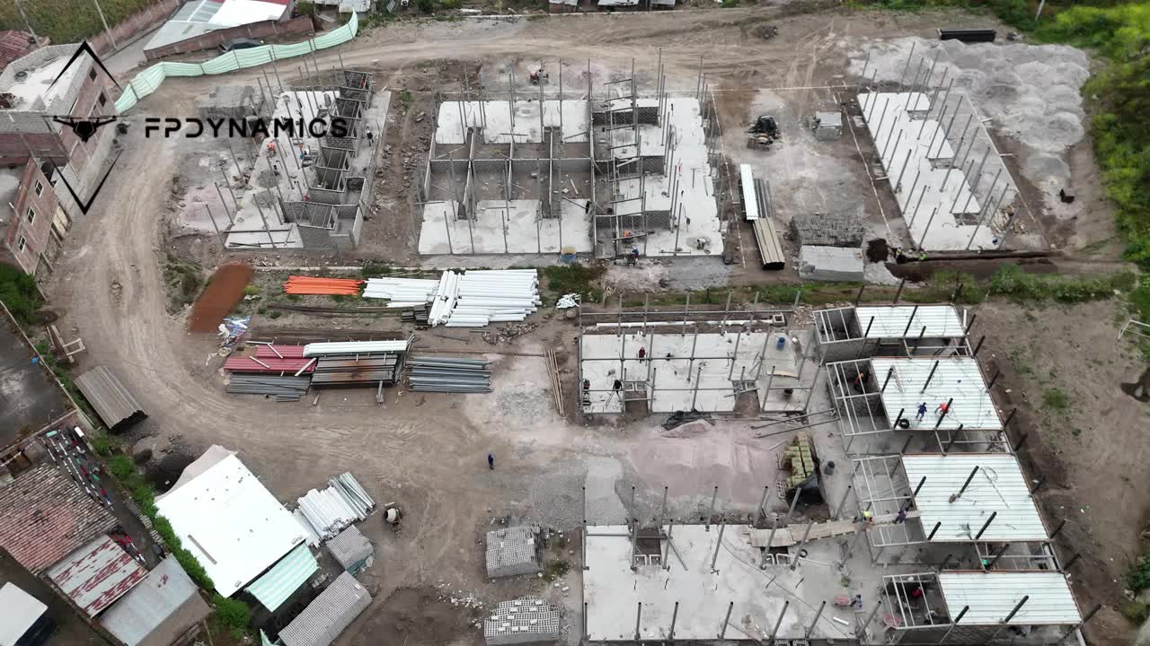
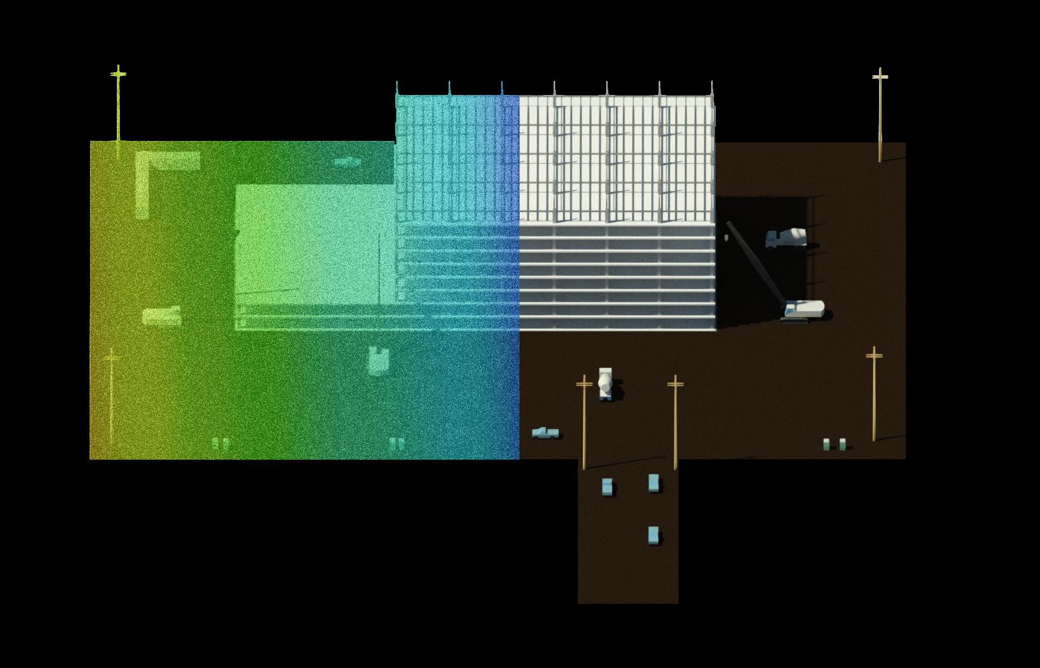
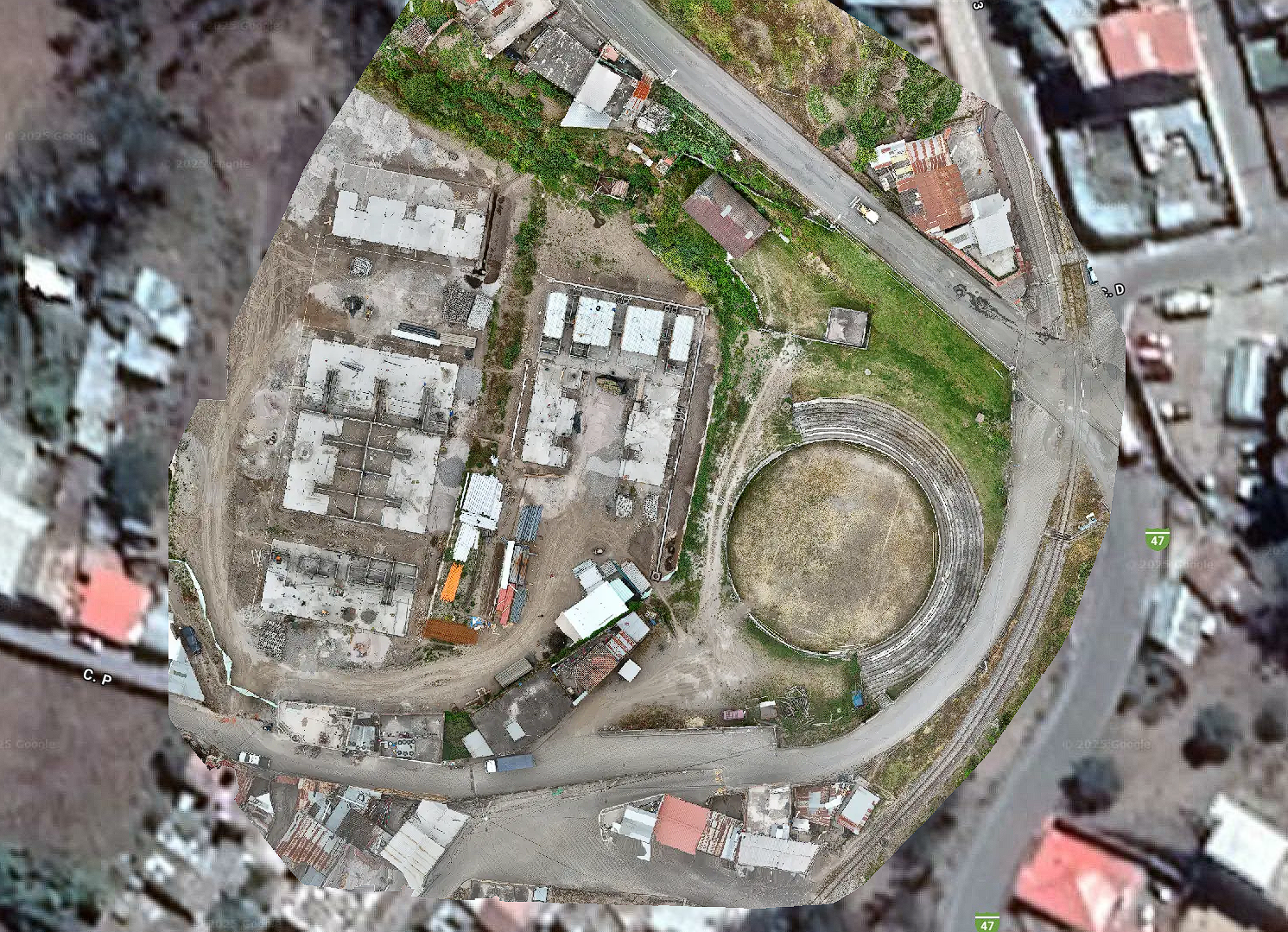
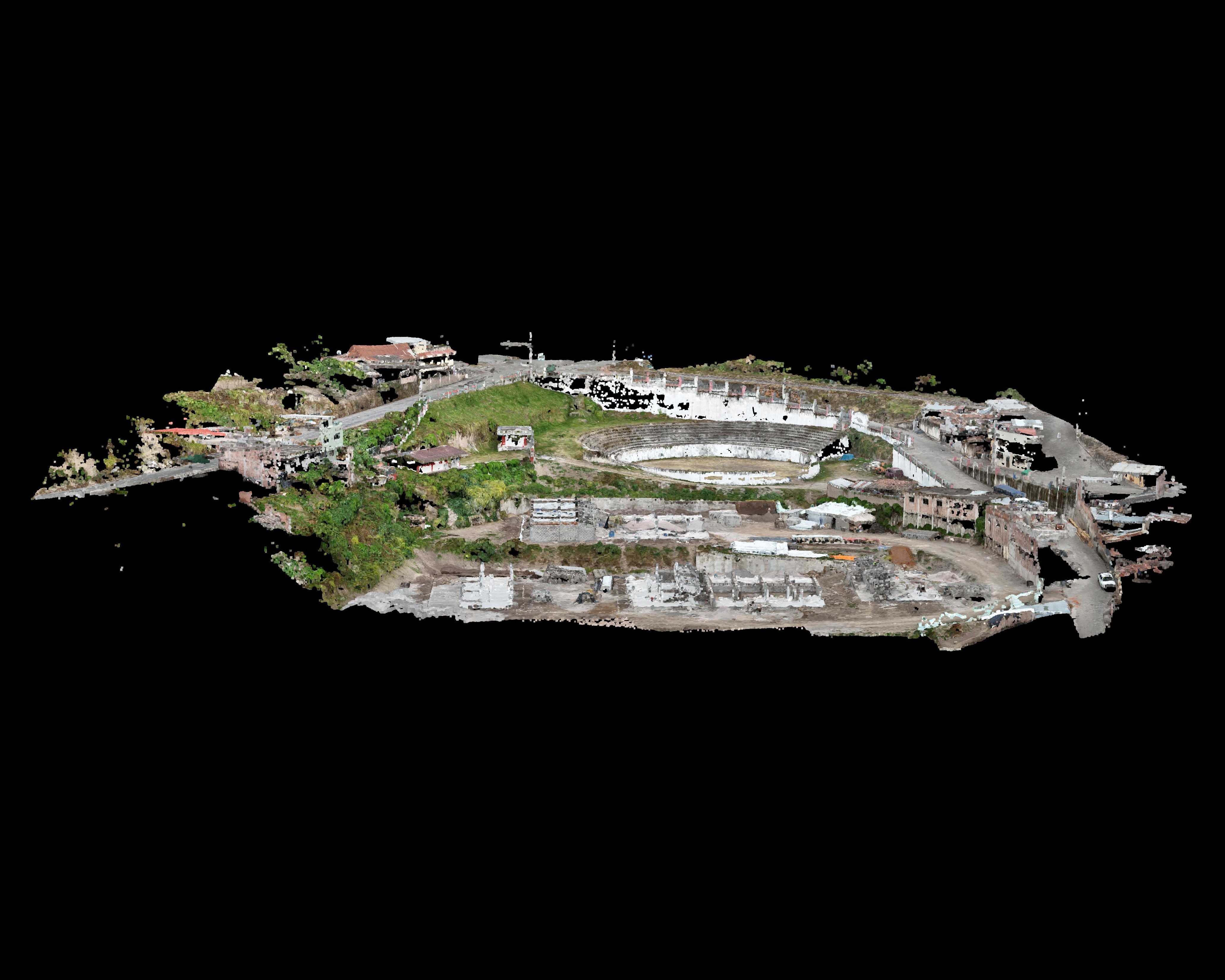
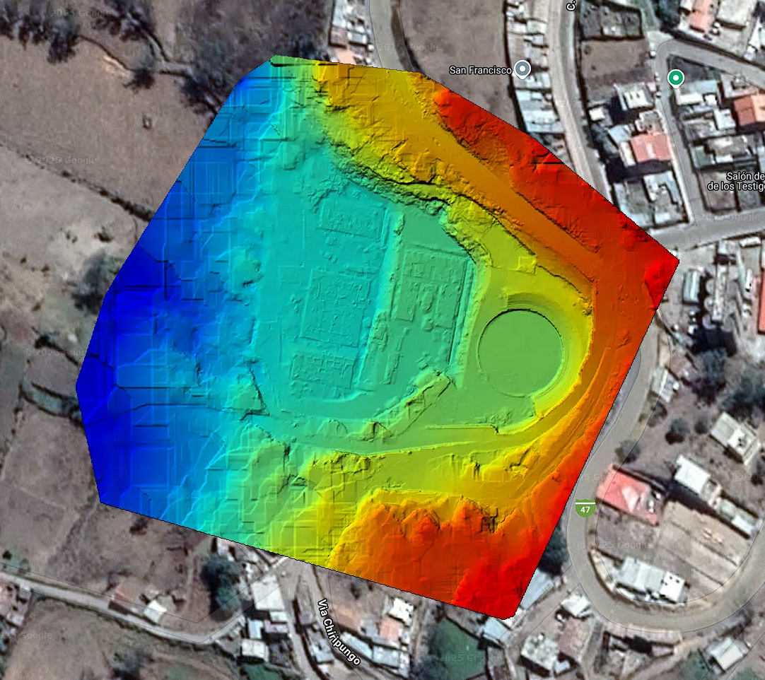
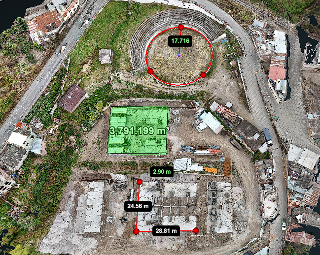
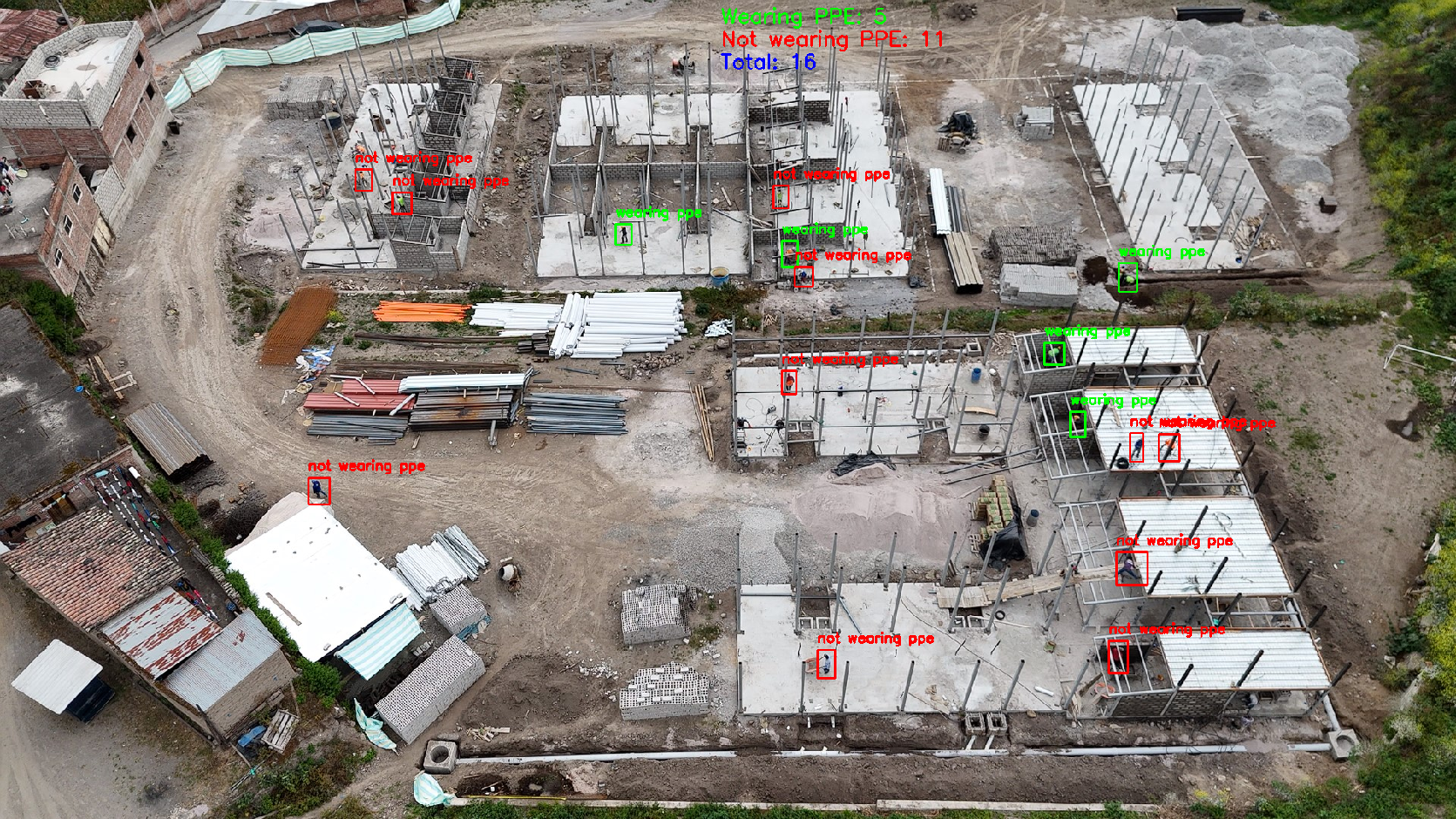
Track progress, verify work, and detect issues before they escalate. Our aerial insights keep your projects moving—on time and on budget. Smarter oversight from above, with zero disruption on-site.

Why Our Aerial Solutions Are the Better Choice

Harness the power of our advanced drone technology and AI-driven workflows to elevate your site oversight. Unlike manual methods, our aerial systems deliver comprehensive, real-time progress views—so you always know exactly what’s happening on the ground, without the cost or delay.

Improve efficiency

Automated flight plans over your entire project area complete in minutes—not days. Instant AI processing turns raw imagery into clear progress reports, freeing your team to focus on action rather than data collection.

Enhance Safety

Keep personnel out of potentially hazardous zones. Our drones perform all inspections remotely—no scaffolding, no heights, no risk—helping you maintain a zero-incident worksite and meet safety targets.

AI Insights

Our AI-driven recognition tools automatically flag anomalies—like earthwork deviations or structural irregularities—and generate concise, custom reports. You get clear, prioritized findings without sifting through raw data.

Lower Operational Costs

Our drones replace expensive lift rentals, helicopter surveys, and overtime labor by capturing detailed site data quickly and affordably. Early detection of deviations prevents costly rework and keeps your budget on track.

Explore our services

Features

BIM (Building Information Modeling)

Turn the built environment into intelligent, data-rich building models. Our BIM services capture, model, and deliver highly accurate as-built information to support design, construction, and facility management.
  • Accurate As-Built Data: Transform drone scans into precise, detailed BIM models for reliable project planning and verification.
  • Streamlined Communication: Give all stakeholders access to a single, up-to-date model to reduce misunderstandings.
  • Lifecycle Asset Management: Embed material, equipment, and maintenance data for long-term building operation.
  • Improved Quality Control: Detect deviations between design and actual site conditions before they cause costly issues.
  • As-Built Documentation: Create models that reflect exact field conditions for record-keeping and compliance.
Features

Orthomosaics

Drone-based orthomosaic mapping dramatically outpaces traditional methods. A single drone can survey hundreds of acres in under an hour, replacing days of ground-based total‑station work. For example, one contractor reported replacing a full day of manual site inspection with a 15‑minute drone flight – saving about five labor-hours per visit.
  • Generates a high-resolution, geo-rectified site map: It enables precise distance and area measurements across the entire construction site
  • Verifies progress and layout: Managers use the orthomosaic to compare actual work (e.g. foundation footprints, pavement) against design plans.
  • Dispute avoidance: Consistent aerial maps reduce miscommunication between stakeholders by providing a single reference for status
Features

3D Modeling

By seeing the actual site in 3D, crews easily identify low/high spots, drainage issues, or misplaced elements. The time saved translates directly to cost: industry reports cite 30–50% cost reductions for inspection and mapping when shifting to drones
  • Earthwork analysis: Easily compute cut/fill volumes by comparing successive models, enabling accurate billing and excavation planning.
  • Grading verification: Drones capture fine details of finished grades, allowing engineers to confirm slopes and elevations are built to spec.
  • Reconstruction and “digital twin”: High-fidelity 3D captures can be archived or fed into digital twins for long-term record and future facility management.
Features

Digital Terrain/Surface Models (DTM/DSM)

Drone-based elevation mapping dramatically outperforms traditional surveys.  Drone topographic surveys can cut effort and cost by an order of magnitude.  Traditional topo-surveys of dozens of acres could take days or weeks; a drone does it in hours
  • Baseline site model: Establish true ground surface before construction (important for bidding and planning, e.g. determining cut/fill).
  • Flood/drainage design: Analyze the bare-earth model to predict water flow and ensure proper drainage grades before construction starts.
  • Change monitoring: Repeat surveys after grading or excavation to verify earthwork volumes and whether work meets design grade.
Features

Volumetric Measurement

Drone volumetrics deliver rapid, repeatable measurements with centimeter precision, reducing man-hours and preventing errors, which quickly pays for the drone service many times over.
  • Stockpile management: Quickly measure current volumes of sand, gravel, or topsoil piles, ensuring accurate inventory for procurement and billing.
  • Equipment calibration: Ensure heavy equipment is using grade correctly by comparing planned cut height vs actual from drone data (avoiding unnecessary rework).
  • Safety: Eliminate manual tape or rod measurements on unstable piles, as drones capture all angles from a safe distance.
Features

Safety and Environmental Compliance

Drones significantly enhance jobsite safety and environmental monitoring without exposing workers to risk.  Aerial drones can inspect fall protection, scaffolding, and PPE usage, or capture safety hazards (e.g. open trenches, standing water, spills) for documentation.  They also monitor environmental controls, such as erosion/sediment fences, stockpile runoff, dust abatement, or wetland encroachments.  Importantly, drone surveillance keeps personnel out of dangerous areas.
  • Regulatory documentation: Automatically archive images of each stage (e.g. erosion control at grading start) to show regulators that plans were implemented.
  • PPE and traffic safety: Monitor whether workers wear helmets/harnesses and whether barricades or signage are correctly deployed on the ground.
  • Hazard inspections: Quickly scan roofs, towers or scaffolds to confirm railings, harnesses, and other protections are in place, without putting inspectors at risk